Interpretable AI for Forest Risk Assessment
Advancing proactive forest monitoring through a high-resolution machine learning pipeline that forecasts deforestation probability using multi-temporal satellite data and environmental drivers.
Study Area: Vietnam’s Central Highlands
The Central Highlands represent a critical intersection of high-biodiversity primary forests and intensive agricultural expansion. Gia Lai Province was selected as our pilot implementation site due to its ecological significance and historically documented deforestation pressures.
Characterized by significant primary forest cover and the presence of protected areas requiring precise risk-based monitoring.
A dynamic landscape experiencing rapid land-use conversion, providing an ideal test case for infrastructure-driven risk modeling.
Spatial Risk Architecture
"Modeling the spatial probability of forest loss at a unified 1 km resolution across heterogeneous landscapes."
The Machine Learning Pipeline
Bridging satellite imagery and proactive conservation intelligence
Data Harmonization
Integration of Hansen GFC labels, Sentinel-2 spectral indices (NDVI/NBR), CHIRPS rainfall data, and SRTM topography into a synchronized 1 km spatial grid via Google Earth Engine.
Interpretable Modeling
Comparative evaluation of Random Forest for high-accuracy discriminative performance and Logistic Regression for transparent coefficient analysis of environmental drivers.
Output Validation
Rigorous assessment using historical hold-out test sets and spatial transferability tests. Generation of continuous probability maps and top-tier warning zones.
Quantifying Deforestation Risk
Our results demonstrate that human accessibility (road proximity) and vegetation condition (spectral indices) are the primary predictors of forest loss risk in the Gia Lai pilot region. The Random Forest model achieved an AUC of 0.892, indicating robust spatial generalization across district boundaries.
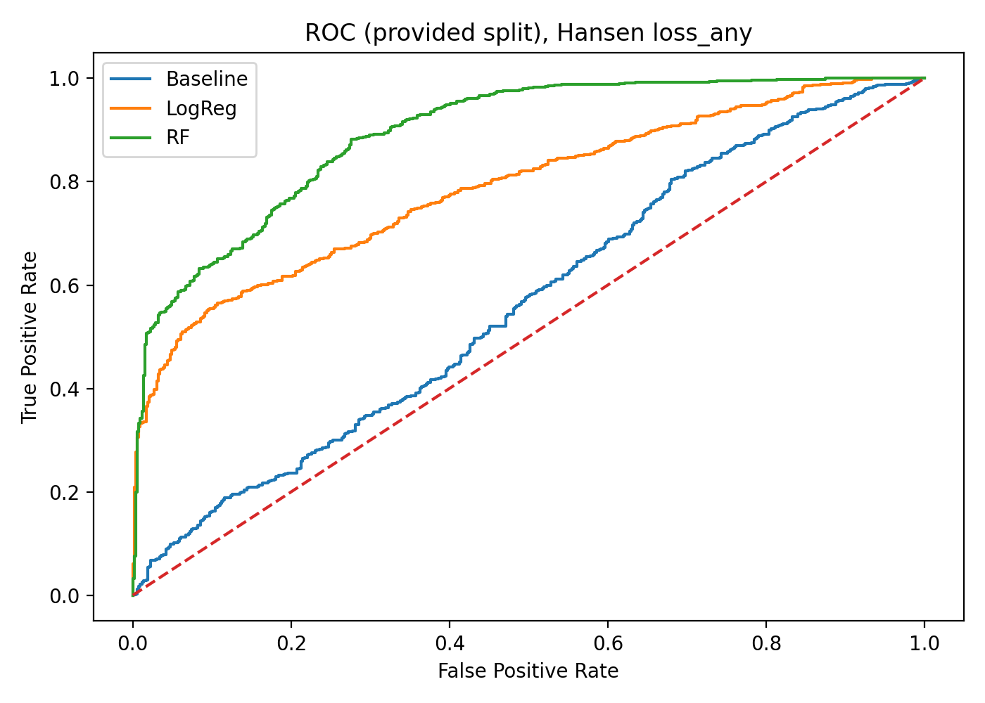
Model Validation (ROC)
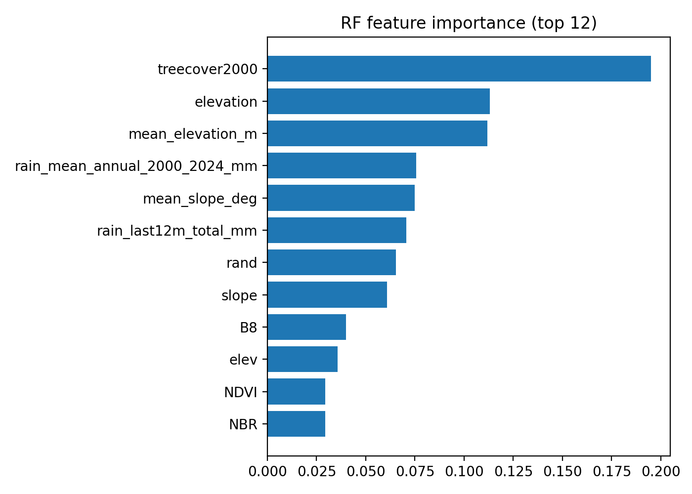
Feature Importance (RF)
Reproducibility & Open Science
Transparency is fundamental to reproducible environmental research. We provide the full computational pipeline, training datasets, and spatial outputs under an open-source framework.
Student Research & Academic Oversight
A collaborative effort by an interdisciplinary team from The Olympia School, Vinschool, and Foreign Language Specialized School, supervised by the SMART LAB at FPT University.